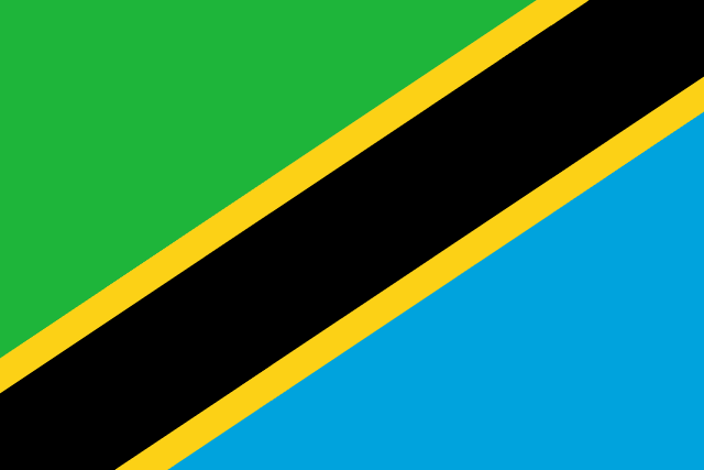
flag — Tanzania
Nation by Nation
Tanzania
Geography
Geography
Tanzania lies on the east coast of Africa just south of the equator, between the Indian Ocean and the great lakes of the African interior. With an area of about 947,000 square kilometers it is the largest country in East Africa, slightly larger than twice the size of California. It borders Kenya and Uganda to the north; Rwanda, Burundi, and the Democratic Republic of the Congo to the west; and Zambia, Malawi, and Mozambique to the south. The country's name joins its two parts: the mainland, formerly Tanganyika, and the islands of Zanzibar, which united in 1964.
The dominant feature of the landscape is a broad central plateau standing roughly 1,000 to 1,500 meters above sea level, covered mostly by dry savanna and miombo woodland. The plateau is framed by the two arms of the Great Rift Valley. The eastern arm runs down through the north of the country past Lake Natron and Lake Manyara; the western arm holds Lake Tanganyika and Lake Nyasa (Lake Malawi). Along the coast a narrow, humid lowland fringed with mangroves and coral reefs stretches for about 1,400 kilometers from Kenya to Mozambique.
On the northern border with Kenya rises Mount Kilimanjaro, a dormant volcano whose Kibo summit, at 5,895 meters (19,341 feet), is the highest point in Africa and the tallest free-standing mountain in the world. Snow and shrinking glaciers cap it even though it stands only three degrees south of the equator. Nearby Mount Meru (4,566 meters) overlooks the city of Arusha. To the west lies the Crater Highlands, including the Ngorongoro Crater, a collapsed volcanic caldera 20 kilometers across whose floor shelters one of the densest concentrations of large animals on earth, and Olduvai Gorge, where the Leakeys uncovered some of the earliest evidence of human ancestors. In the south, the Southern Highlands around Mbeya and Iringa are cool, fertile, and intensively farmed.
Tanzania shares three of Africa's greatest lakes. Lake Victoria in the north, the largest lake in Africa and the source of the White Nile, is split with Uganda and Kenya; Tanzania holds the largest share of its surface. Lake Tanganyika on the western border is the longest freshwater lake in the world and, at more than 1,470 meters, the second deepest after Lake Baikal; its floor lies well below sea level. Lake Nyasa in the southwest is shared with Malawi and Mozambique. Smaller lakes, including the soda lakes Natron and Eyasi and the freshwater Lake Rukwa, fill basins of the Rift.
The largest river is the Rufiji, which drains much of the south and center before reaching the Indian Ocean opposite Mafia Island through a wide delta. The Pangani flows from the slopes of Kilimanjaro to the coast near Tanga, the Ruvuma forms the border with Mozambique, and the Kagera, which feeds Lake Victoria, is the most distant headstream of the Nile.
More than a third of Tanzania's territory is set aside in national parks, game reserves, and conservation areas, one of the highest proportions in the world. The Serengeti plains in the north host the annual migration of well over a million wildebeest and zebra between Tanzania and Kenya's Maasai Mara. The Nyerere National Park and Selous Game Reserve in the south, together with Ruaha, Mikumi, and Katavi, form one of the largest expanses of protected wilderness in Africa. Gombe and Mahale Mountains on Lake Tanganyika are famous for chimpanzees, and the Mafia Island marine park protects coral reefs and whale sharks.
Off the coast lie the islands of the Zanzibar archipelago, chiefly Unguja (Zanzibar Island) and Pemba, with Mafia Island farther south. Low-lying and coral-built, they are warm and humid year round and were for centuries the center of the Indian Ocean spice and slave trades; cloves are still grown on Pemba. Zanzibar's Stone Town, with its Arab, Persian, Indian, and European architecture, is a World Heritage site. On the mainland coast the commercial capital Dar es Salaam, the country's largest city and main port, faces the ocean; the official capital was moved inland to Dodoma on the central plateau, a transfer completed in recent years.
Tanzania's climate is tropical but varies greatly with altitude. The coast and islands are hot and humid, with temperatures near 30°C most of the year. The central plateau is drier and hotter by day and cooler at night, while the highlands can be cool enough for frost. Rainfall follows two patterns: the north and east have two rainy seasons, the long rains from March to May and the short rains from October to December, while the south, west, and center have a single wet season from about November to April. Drought is a recurring hazard in the central regions, and the coast is occasionally affected by cyclones from the Indian Ocean.
The country is rich in minerals. Gold from the Lake Victoria goldfields is the leading export, and the Williamson mine at Mwadui has produced diamonds since 1940. Tanzanite, a blue gemstone found nowhere else on earth, is mined only in the Mererani hills near Kilimanjaro. There are also deposits of coal, iron, nickel, uranium, and graphite, and large reserves of natural gas have been found offshore. Fertile volcanic soils in the north and the Southern Highlands support coffee, tea, and maize, while the plains carry sisal, cotton, cashews, and cloves. Tanzania's population has grown past 65 million, concentrated around Lake Victoria, the northern highlands, the coast, and the Southern Highlands, leaving much of the dry interior thinly settled.